Four days, a run of bad luck, a decent amount of suffering, and possibly a bit of fun describes our recent trip to Katahdin.
Pascal is a kindred spirit, that is, he prefers to spend his Spring Break chasing remote ice climbs in Northern Maine to drinking on a beach. I took advantage of a lull in the grant writing-thesis committee meeting business to make a quick (by Katahdin standards) four day trip up North to climb Katahdin's most famous ice climb, the Cilley-Barber.
I picked him up in Nashua around 3:00pm on Friday the 6th, and with a quick stop in Portland to rent him some metal edged cross country skis, we were on our way to Millinocket; the gateway to Katahdin.
March 7th: Abol Bridge to Roaring Brook
Katahdin is remote. I mean, it's a 6 hour drive and then two days of skiing just to get to the base of the thing. From the parking lot at Abol Bridge, it's a 12 mile slog up the Roaring Brook road to the campground where we would spend the first night. The route takes the AT for 3/10 of a mile and then turns hard right onto the Abol Stream Trail, which eventually intersects Park Tote Road. 2.5 miles along the road will take you to the Togue Pond entrance, and from there, it's 8 miles up the Roaring Brook Road. It's relatively flat, gaining only about 1000' over the course of 12 miles.
Our bad luck didn't waste any time getting started; we missed a turn right off the bat and ended up going an additional 2 miles out of our way, turning our 12 mile ski into a 14 mile ski on the first day. We had 4 days worth of food, plus all our clothing and technical equipment for multiple winter nights out in the Northern Maine wilderness. We split it among two backpacks and a sled. Even with the sled, the skiing was relatively pleasant. Toward the end, the miles dragged on. We made it to Roaring Brook camp in about 7.5 hours, absolutely knackered.
 |
| 4.5 miles in and we're just at the park entrance? |
 |
| Yep, 6 miles in, 8 still to go. Photo: Pascal Liddane |
 |
| That mountain is far away |
 |
| Finally in camp, night #1 |
March 8th: Roaring Brook to Chimney Pond
Getting to Chimney Pond is another story. From Roaring Brook, Chimney Pond is 3.3 miles and about 1500' of elevation gain...significantly steeper. This we knew, and we knew we'd be dragging a sled, so we brought skins for our cross country skis. Turns out, I significantly underestimated how much power is required to drag a 45lb sled up a trail that steep. Even with skins, the struggle was real. To make matters even better, the fuel canister we used the night before sprung a leak, and was dead empty by the time we got up in the morning, cutting our fuel supply down by about a third.
Our weather was also turning for the worse. Our forecast suggested clouds would build and we'd get a bit of snow and wind, but the winds were much faster than anticipated and it was snowing harder than forecasted by the time we arrived at Chimney Pond. I also managed to fall part way through and put a sled pole through the screen of my cell phone. Awesome.
 |
| Rise and shine Pascal! |
 |
| Donning skins for the ascent to Chimney Pond |
 |
| The trail is much more narrow than the Roaring Brook Road |
 |
| Type II fun |
 |
| Dragging the sled across Basin Pond, the mountain looms. Photo: Pascal Liddane |
 |
| Type III fun |
 |
| Home for the next two nights at Chimney Pond |
 |
| Lots of fresh snow and high winds seen from Chimney Pond |
We arrived at Chimney Pond in the early afternoon, and already about 4 inches of snow had fallen. Over the next two days, our forecasted 1-2 inches of snow would turn into 10-12 inches of snow. When it finally cleared enough to get a view of the Cilley-Barber, I saw a wind loaded death trap. After talking to the Rangers and folks who had been climbing that day, we decided on an objective with a different aspect: Pamola's Fury Left.
March 9th: Pamola's Fury Left
We awoke Monday morning to even more snow. By now about 6 more inches had fallen, and the entire mountain was whited out. We took a little longer getting ready, and waited to see if better conditions would show up. Spoiler alert: they didn't. We decided since we came this far we might as well see how far we could get before having to turn around, so we signed out at the Ranger cabin and headed for Pamola's Fury Left.
 |
| There's a mountain in there somewhere |
 |
| The route from below during a short calm spell |
 |
Starting up the route. It follows the low angle gully seen here until the crux ice pitches seen above
Photo: Pascal Liddane |
 |
| Simul-climbing the lower gully |
 |
| The first crux pitch from below |
 |
| Crossing a deep, somewhat loaded slope beneath the crux |
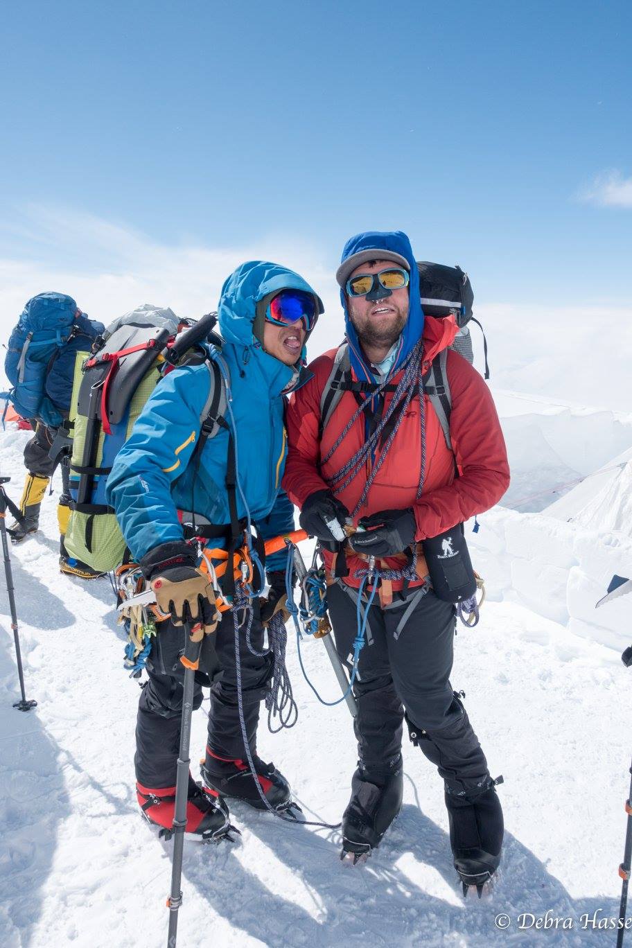
We simul climbed about 500 feet of snow and low angle ice to reach the base of the first crux pitch. It was in great shape, but the gully above was seriously loaded. We also managed to core-shot our rope, so we decided it was time to descend. Conditions were only getting worse, despite the forecast. We were learning not to trust that. We made several gnarly rappels and then down climbed the rest of the way.
 |
| Core shot in the rope |
 |
| High point selfie! |
 |
| Rapping through the gnar |
 |
| Post holing back to camp |
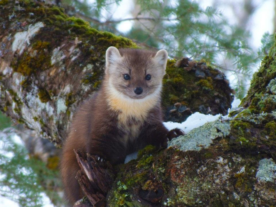
So much snow had fallen during our few hours on the route that we had trouble finding our tracks back to camp. When we finally got back, we saw that a pine marten had figured out our clever food hanging mechanism and stolen the rest of our food. If you don't know what a pine marten is, they look like ferrets, but douchier.
 |
| Pine marten. Don't be fooled by the cuteness. Creative Commons photo |
 |
| Pascal back in camp, just after learning about the missing food. |
We still had some food left over in our backpacks that we were planning to eat on the climb, and for some reason the animals didn't touch our freeze-dried, pre-packaged dinner and breakfast (wonder why?) We were able to ration our food out so we had a bit for that afternoon and the next day. That night we hung our remaining food from a metal cable the Rangers keep just for this purpose. There was a bit of clearing that night, though the winds remained high throughout the night.
 |
| High winds at sunset |
March 10th: Chimney Pond to Abol Bridge
We knew we had a very long day ahead of us, trying to get all the way back to the car in one go, so we got up early with the intention of eating breakfast and tearing down camp quickly. We woke up to discover that the damn pine martens had stolen our food AGAIN. In a fit of improbability, I was able to follow the right set of tracks back the little assholes' den and recover our stuff sack, freeze-dried breakfast (yum), and our one remaining cup and spoon. The rest of it was gone. We did our best to patch the tooth holes and ate breakfast quickly, knowing that our long day had gotten even longer. Besides breakfast, we were each down to a packet or two of Shotbloks and Honey Stingers, which are basically gummy bears for adults.
 |
| Dawn over the South Basin. The winds were still about 35 mph at the summit. |
We broke down camp quickly, and began the long ski out. We finally got a bit of a break and found excellent snow conditions for the first part of our day. We skied the challenging Chimney Pond trail back to Roaring Brook in just under an hour, leaving skins on most of the way.
 |
| Leaving Chimney Pond at sunrise |
 |
| Crossing Basin Pond into the sun |
We made good time from Roaring Brook to Togue Pond, covering those 8 miles in a little over 3 hours. Just when the forest realized we were enjoying ourselves, BAM, the snow turned to wet concrete in the space of maybe 10 feet. No more kicking and gliding, our skis accumulated giant lumps of snow on the bottom with each stride, slowing our pace to a crawl for the last 4 miles. It would have been perfect conditions for kick wax, but did we have any? Of course not! After a while, Pascal opted to take his skis off and just boot it, while stubborn me refused to give in, dragging my cemented skis hoping for those short stretches of downhill where I could clean my skis and glide a bit.
 |
| Skis aren't supposed to do that |
 |
| Sometimes, walking is easier. |
After 4 miserable miles, we finally made it back to the car, just 6 measly hours of driving ahead of us.
Even though we couldn't catch a break, we made the most of some bad conditions. Next time, I would do a couple things differently. First, I wouldn't miss the turn to the Abol Stream Trail. Like I said, it added an additional 2 miles to an already long day. It's a serious slog with heavy packs and sleds as it is, no reason to add to it.
I'm still not sure what to do differently with our food. A bear canister would definitely have solved the problem (assuming pine martens can't roll it away somehow), but they're heavy, bulky, and with limited storage capacity. Hanging food seems out of the question. They were able to claim our food from the middle of a 40 foot steel cable meant to keep bears from getting it, for crying out loud. Honestly, short of storing food in the bunkhouse, I probably would bring it inside the tent with me. The risk of bears coming around in the winter is very low, and the pine martens didn't come near our tent while we were inside.
Finally, I would only do this trip with more time. We had horrible luck with the weather. It was clear and blue for both days in and out of Roaring Brook, but horrible within. People were climbing everything in the few days before we arrived, and we were the only ones who attempted anything on the day we went out. If we had more than just one full day at Chimney Pond, we'd have been able to do some serious climbing as well. If we had just one more day, we could have summited a technical route.


